

Set Beside a New Bike Lane, This Project Aims to Bring Vibrant, Connected Living to Jubilee
In Development
2612-2628 Richmond

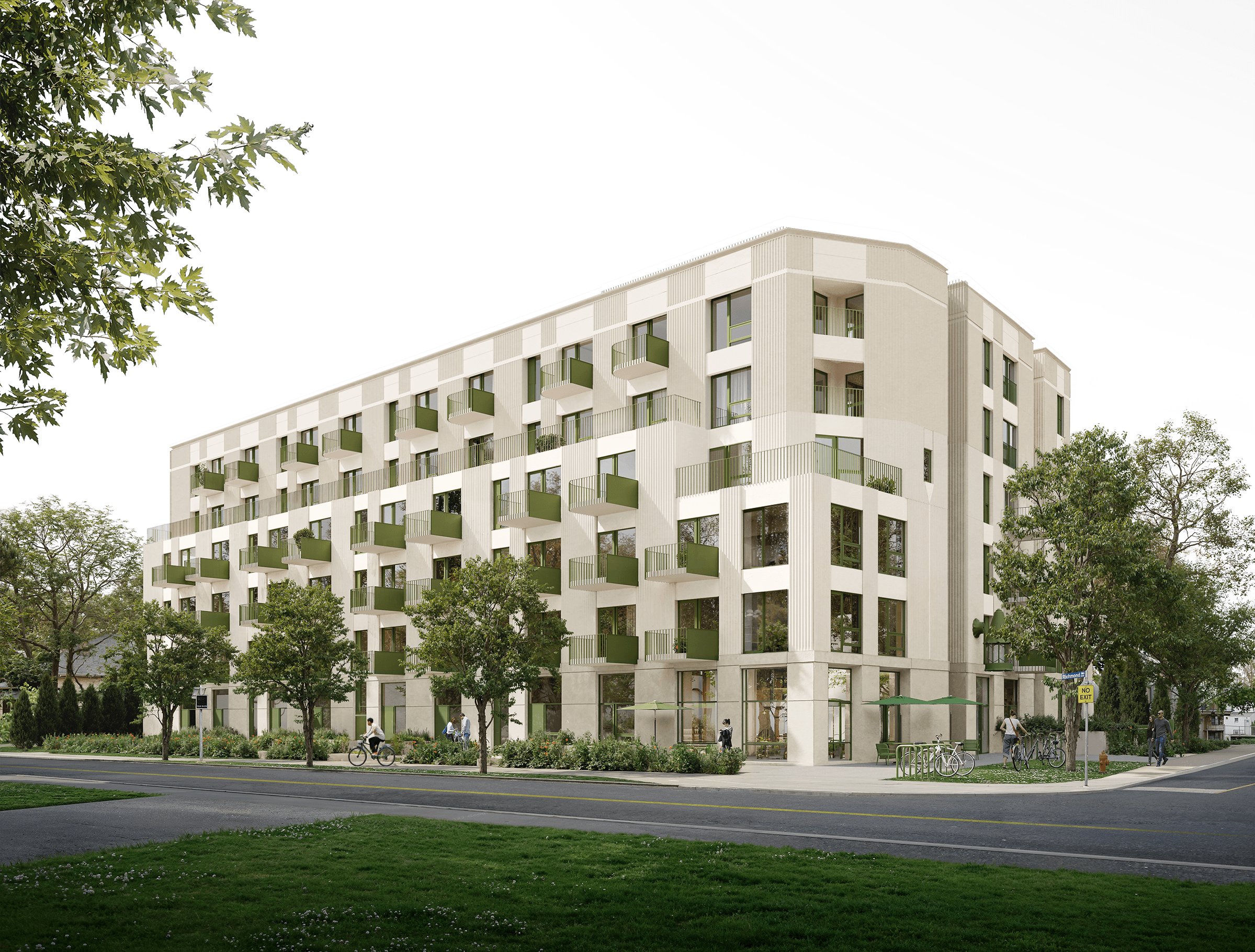
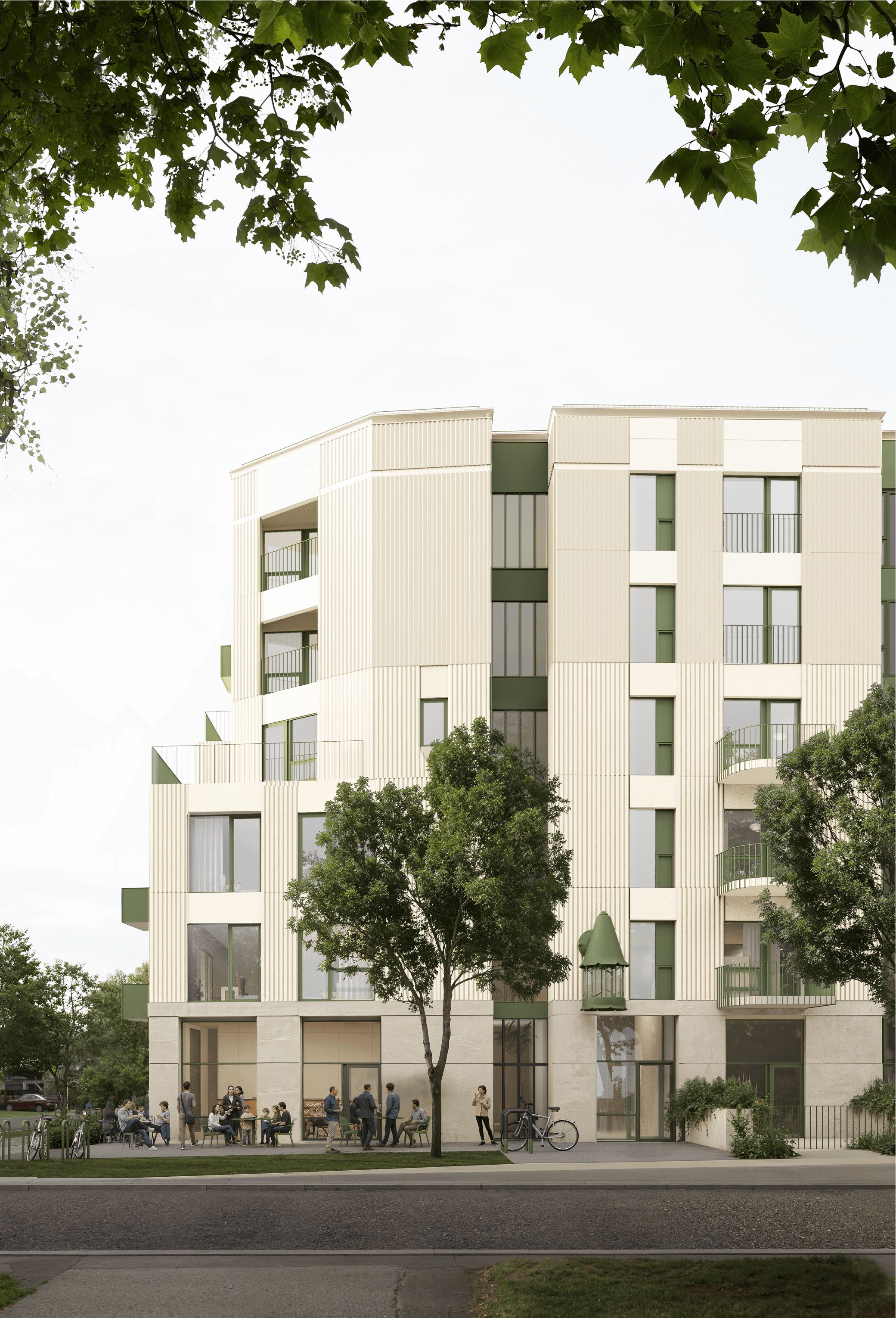
The proposed development at 2612–2628 Richmond Road is a 6-storey, purpose-built rental community in North Jubilee. Currently in the planning approval process, this thoughtfully designed building aims to offer 105 rental homes—ranging from studios to three-bedroom suites—alongside a neighbourhood-serving retail space, complete with a landscaped patio and welcoming pedestrian boulevard. Set beside a new bike lane and enhanced streetscape, this project aims to bring vibrant, connected living to this evolving community.
Project Team
Want to learn More?


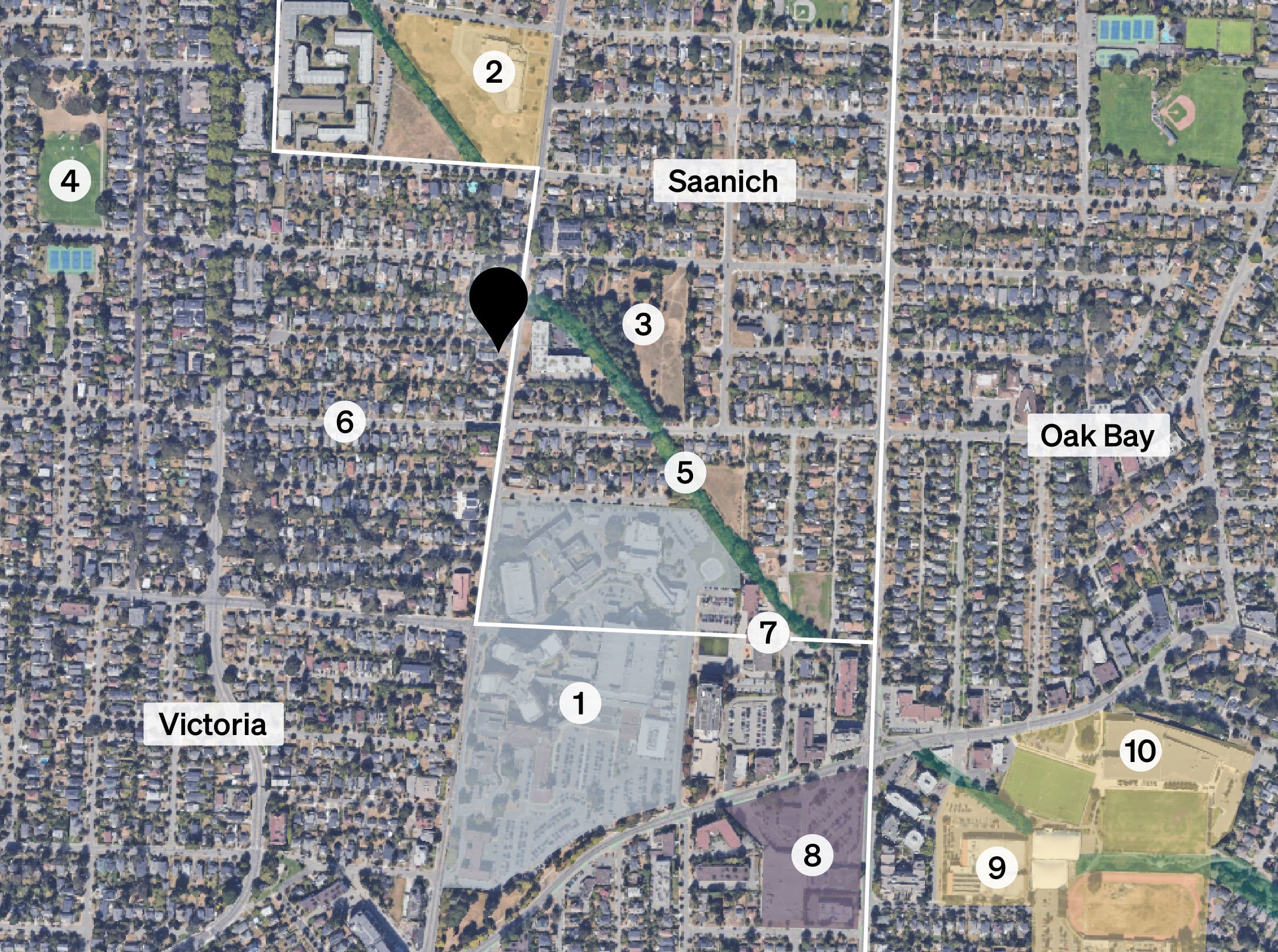
Site Context
Situated within the North Jubilee neighbourhood, the site benefits from a fine grained urban fabric composed of residential and mixed-use buildings surrounding the Royal Jubilee Hospital, with convenient access to nearby amenities that support daily life. This area also functions as a key junction linking the adjacent municipalities of Saanich and Oak Bay.
The area is characterized by a mix of single-detached homes, low-rise residential buildings, institutional uses like the Royal Jubilee Hospital and small-scale commercial spaces along major corridors. Richmond Road serves as a key secondary arterial, connecting residential areas with employment zones and urban villages. In response to expected growth, North Jubilee is evolving to support more diverse housing. This site offers a strategic opportunity for a 6-storey, purpose-built rental building that fits the corridor’s emerging scale, provides a transition to lower-density housing and enhances the pedestrian experience along Richmond Road.

In response to the anticipated urban growth along this corridor, the North Jubilee neighbourhood is evolving to support more diverse and compact forms of housing.
Area Context
Subject Site
Royal Jubilee Hospital
Lansdowne Middle School
Kings Park
Oaklands Park
Bowker Creek Greenway
Haultain Street Greenway
St. Patrick’s Elementary School
Commercial Plaza at Fort & Foul Bay
Oak Bay Recreation Centre
Oak Bay High School
Project Pillars
Creating a Neighbourhood Corner
As part of this development we are seizing the opportunity to replace the existing commercial unit with a thoughtfully designed public realm that contributes meaningfully to the neighbourhood. At the corner of the site, the proposal includes a small- format retail space—under 1,000 square feet—intentionally sized to support local businesses such as a café or convenience store.

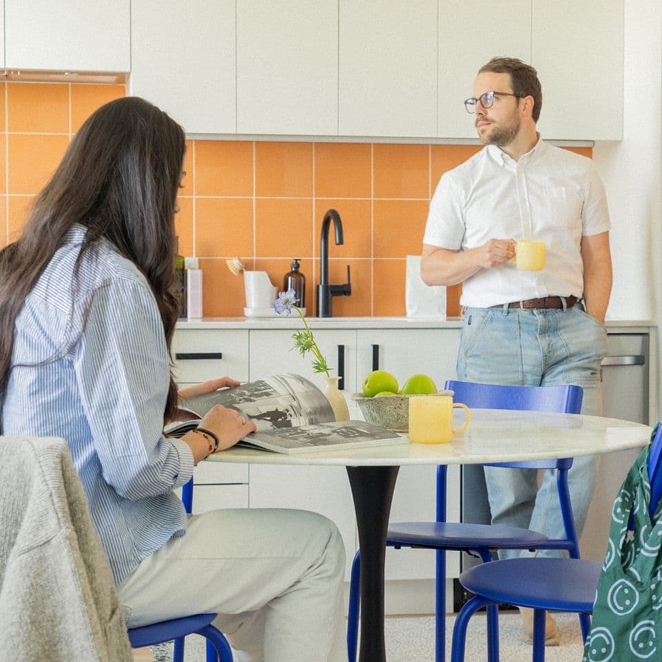
Thoughtfully-Crafted Rental Housing
To meet the growing demand for modern rental housing in this neighbourhood, the building will be thoughtfully designed and constructed using contemporary building technologies and durable materials to ensure long-term performance and timeless appeal. Each unit will feature a carefully considered layout that prioritizes efficient, livable space with ample natural light and ventilation.
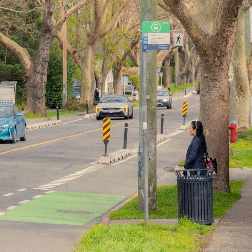
Sustainable Transportation Support
The site’s proximity to a major employment hub and nearby urban amenities aligns with the City’s policy direction to reduce car dependence in key growth areas by promoting sustainable transportation options such as walking, cycling and transit. This proposal supports that vision through an enhanced pedestrian experience, including treed boulevards and active ground-floor residential frontage that contribute to street vibrancy and safety.
Timeless Architecture
As cities evolve, a natural balance emerges between iconic buildings that define a skyline and the background architecture that shapes the everyday character of a place. Our approach to this development embraces the latter—delivering a timeless yet distinctive mid-rise form that enhances the street through active residential use and thoughtful urban design. The building’s composition, materiality, and relationship to the public realm are intentionally crafted to contribute to the evolving landscape of Richmond Road, reinforcing its identity as a vibrant, livable corridor.

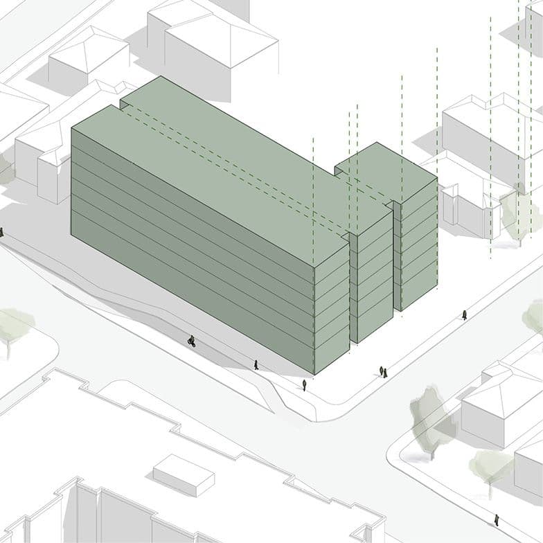
Massing & Design Approach
Our design approach is grounded in response to the scale and rhythm found in the built forms and the fabric of the residential neighbourhood while it adopts an efficient and progressive design appropriate for its scale and make a respectful transition in perception and experience of this transformative architecture.
This design strategy explores how we can shape a new 6-storey built form to sit as a positive addition to Richmond Road whilst establishing purposeful relationships to neighbours. Our approach is formulated by four key steps;
Step 1
The design approach began with the neighbours and pedestrians’ perception and experience of the building in mind. The 6-storey building massingis positioned fronting Richmond Rd and Carrick St with setbacks to allowwidened, landscaped boulevards and a spacious setback towards the neighbourhood to the west to help making the height transition and reduce shadow impact. The building shape and the floor plate are designed to support an efficient and functional layout of the residential units and the required programs in relation to the servicing streets. The massing elevation facing Carrick St is sculpted with indents to match similar widths of the neighbouring properties and maintain a consistent rhythm of the building face and scale at the pedestrian level.
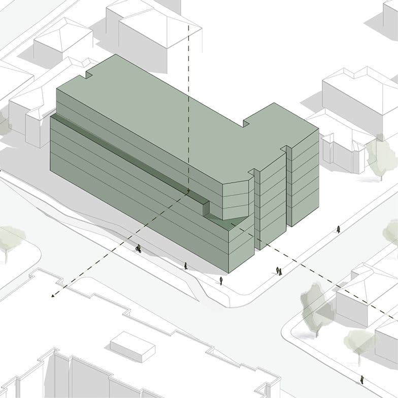
Step 2
In further efforts to enhance the perception of the building frontage,the massing elevation is further refined along Richmond Rd—lowering the streetwall to four storeys and setting back the upper two levels - to improve the perception of the height transition. Towards the intersection of Richmond Rd and Carrick St, the building corner further steps down to three storeys and is carved to soften the transition towards the neighbouring properties on Carrick St. This approach also allows more natural light to move around the building and maintains an open, sky-facing streetscape. Overall the massing strives to reach a fine balance of the building’s scale and position in response to the neighbourhood, to the perception of the building scale at grade and to improve pedestrian experience on the right-of-ways.
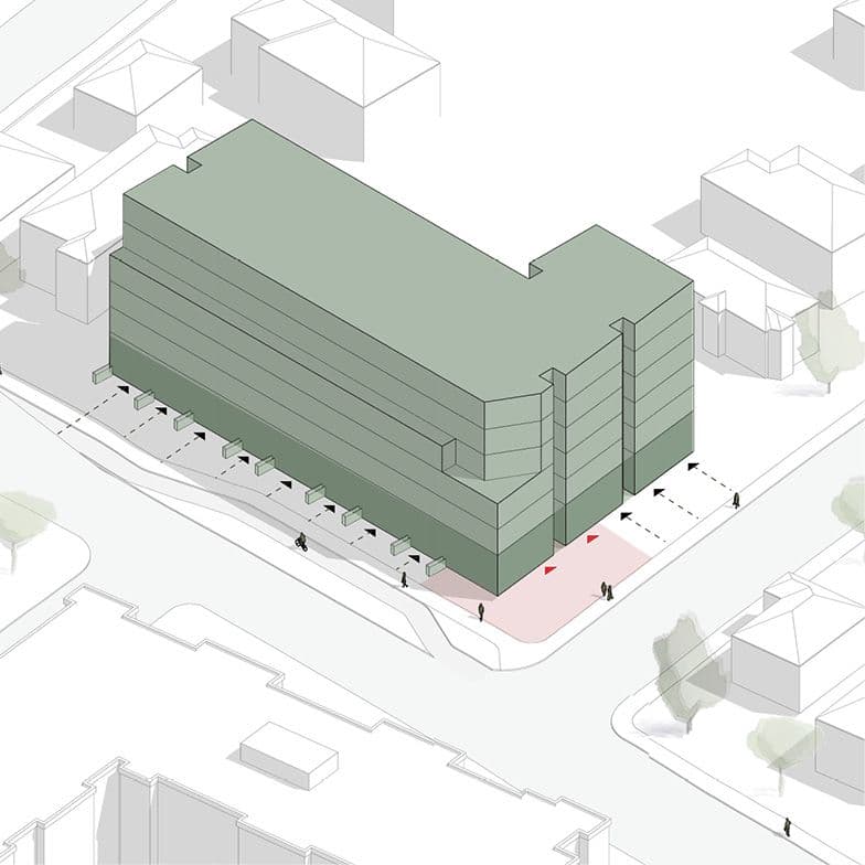
Step 3
Next step focuses on the appearance and experience of the building elevations at grade. Along the pedestrian walkways are lined with ground-floor residential suites up to a mezzanine height that corresponds to the similar width and height of the neighbouring houses. This keeps the continuation of the residential fabric along the streets while providing a visual interest and eyes to the streets. At the corner meets the ground-level retail space with the outdoor patio serving as a transition turning around the corner. Looking above vertically, a consistent, modulating elevation of what makes up a building elevation - windows, doors and balconies - follows a simple rhythm that’s easy to read and follow, thus creating a gentler, refined appearance and reducing the visual impact of the building elevation at the street level.
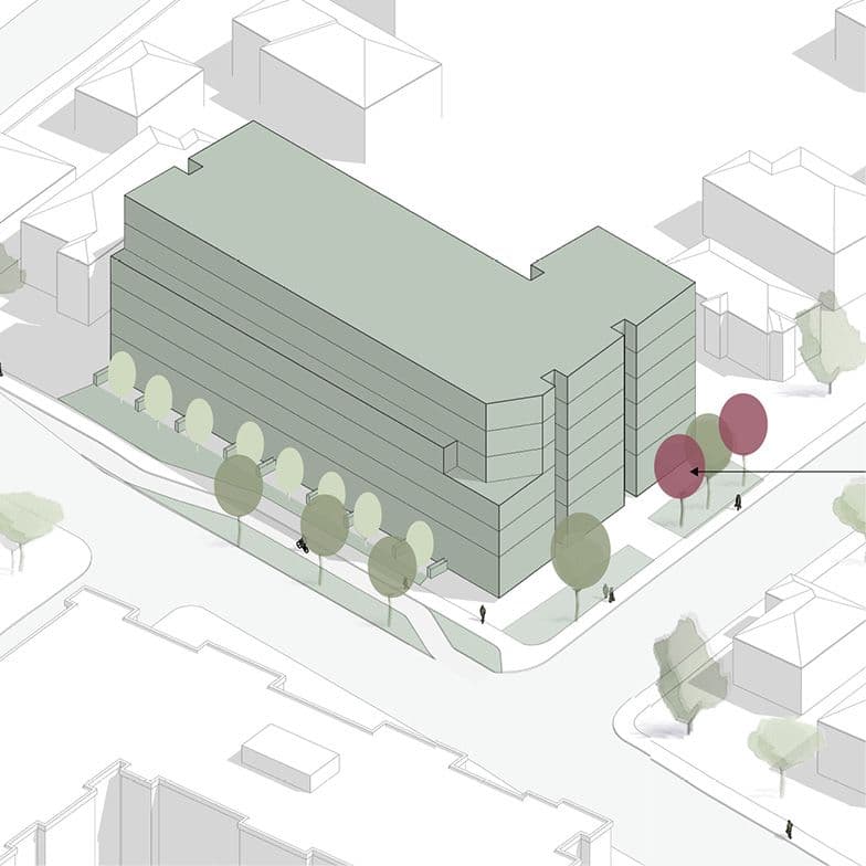
Step 4
The last step builds on further conditioning the building frontages with a refined landscape design and planting of new trees along the pedestrian boulevards, supplemented with the ground-floor suite terraces as a setback, to provide a respectful transition between the private and public realms. As the tree canopy matures over time, the building will recede into the background and seamlessly integrate as a part of the overall streetscape while reinforcing the landscape character of the surrounding context. The result is a building that feels both grounded and progressive in design that responds appropriately to its proposed scale and contributes meaningfully to the evolving character of the neighbourhood.
*approximate massing visualization only—refer to drawings for up to date design

Projects At A Glance

Number of Storeys
6 Storeys
Height
18.8m
Site Area
29,600 sf
Floor Area
71,655 sf
FSR
2.56
Site Coverage
52%

Front Setback
5.1m
(East / Richmond Rd)
Rear Setback
9.5m
(West)
Side Setback
4.6m
(North / Carrick St)
Side Setback
3.2m
(South)

Number of Homes
105 Homes
Studio
38 Homes
One Bedroom
35 Homes
Two Bedroom
21 Homes
Three Bedroom
11 Homes

Car Parking Stalls
44 + 1 Car Share
Long-Term Bike Parking
146
Short-Term Bike Parking
11
Residential Tenure
Market Rental
Affordable Homes
11
Renderings
View from Richmond Road looking south west

Neighbourhood commercial space on the corner of Carrick Street and Richmond Road
Site Plan & Landscape Design
The site planning for this development has been carefully shaped to balance the building’s massing with the site’s physical constraints, while thoughtfully addressing both development requirements and broader objectives the proposal can achieve.
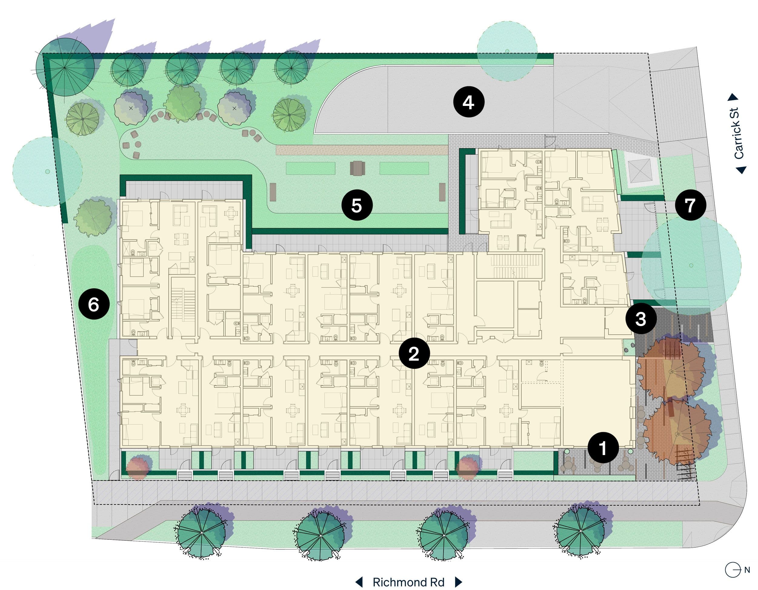

Retail Space & Outdoor Patio
A key element of the proposal is the repositioning of the retail space to make it more accessible and inviting to the neighbourhood. Approximately 919 square feet of ground-floor retail is proposed at the corner of Richmond Road and Carrick Street, paired with a generous outdoor patio. Enhanced with street furniture, a green canopy and landscaped planters, this space offers a sheltered and welcoming gathering place, buffered from the activity of Richmond Road.

Ground Floor Suites
Ground-level residential units are oriented toward the street to reinforce a continuous and active residential frontage along pedestrian pathways. A landscaped setback with trees, shrubs and private patios creates a soft transition between public and private realms—offering privacy for residents, visual interest through the seasons and improved pedestrian safety through passive surveillance.

Residential Entrance
The main residential entrance is located on the quieter Carrick Street frontage, allowing a clear distinction between residential and commercial access.

Underground Parkade
Vehicular access is provided from Carrick Street, leading to a discreetly located parking area on the interior of the site. To protect the privacy of adjacent properties and mitigate noise and light spill, a tall cedar hedge and mid-sized trees are proposed along the west and south site boundaries. Across the site, where hardscape is not required, soft landscaping and planting areas have been prioritized to maximize greenery and ecological benefit.

Urban Garden & Outdoor Amenity
Urban Garden & Outdoor Amenity
An outdoor seating area is strategically positioned behind the building, backing onto a treed area to serve as a functional extension of the living space, offering a quiet environment for relaxation and social interaction. Adjacent to the seating, an urban gardening area allows residents to grow their own food and engage in sustainable urban agriculture.

Rainwater Management
The landscape strategy includes over 9,000 square feet of planted and permeable surfaces, including a rain garden and bioswale. This system is designed to meet the City’s rainwater management targets—reducing pressure on municipal infrastructure, improving site resilience and minimizing stormwater impacts to nearby Bowker Creek.

Richmond & Carrick Boulevards
Streetscape upgrades are proposed for both Richmond Road and Carrick Street to enhance the pedestrian experience. Along Richmond Road, a 2.44-metre road dedication allows for a widened sidewalk, a 2.5-metre protected bike lane and a treed boulevard, improving safety and connectivity. Carrick Street will see a similar treatment, with a continuous, landscaped boulevard that includes native and adaptive plantings. In both locations, planting zones are designed to provide adequate soil volume to support healthy and sustainable tree growth over time.
Mobility Context
The subject site is located within a well-connected, walkable neighbourhood that supports a range of transportation options. Its proximity to frequent transit routes, cycling infrastructure and pedestrian access to everyday essentials makes it an ideal site for a car-lite lifestyle.
Mobility Context
The proposed development is located in a highly accessible, multi-modal transportation area that supports walking, cycling, and transit. Within a 5–10 minute walk, future residents can access daily needs like groceries, parks, medical services, and the Royal Jubilee Hospital.
Traffic and Parking Management
The Transportation Impact Assessment completed by Bunt & Associates concludes that the proposed development will generate minimal vehicle traffic—estimated at approximately 28 trips during the PM peak hour, or roughly one vehicle every two minutes.
Transportation Demand Management
To support the reduced parking supply and promote a car-lite lifestyle, the Transportation Demand Management plan includes a range of targeted measures. A dedicated Modo car-share vehicle will be provided, complete with an on-street EV charging space.
Subject Site
Bus Stop
Car Share
AAA Protected Lanes
Painted Bike Lane
AAA Shared-Use Street / Pathways
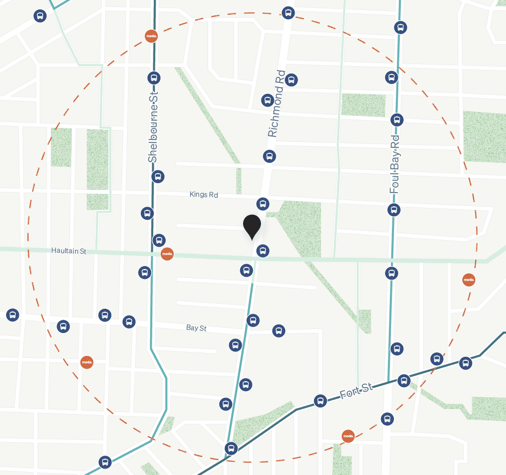
These strategies collectively aim to reduce private vehicle ownership, reinforce sustainable travel habits and support the project’s alignment with Victoria’s mobility and sustainability goals.
Development Timeline
Step 1
Pre-Design Consultation
Step 2
Design Development
Step 3
RZ/DP Submission
Step 4
RZ/DP Approved
Step 5
Building Permit Submission
Step 6
Building Construction
Step 7
Tenant Occupancy
Want to learn More?
Register Now
We are committed to being good neighbours and having honest, open dialogues within the communities where we do our work.
We are available to discuss project details with neighbours and stakeholders to build trust and shared vision for the project.
Register to learn more about the proposal and stay informed throughout the approval process or get in touch with us directly at community@aryze.ca.
Browse some of our projects to see our city-building work in action.


Stay in the loop
Get architectural and development insights, curated articles and design inspiration.
Sign up for our quarterly newsletter Blueprint, and receive the most recent issue today.